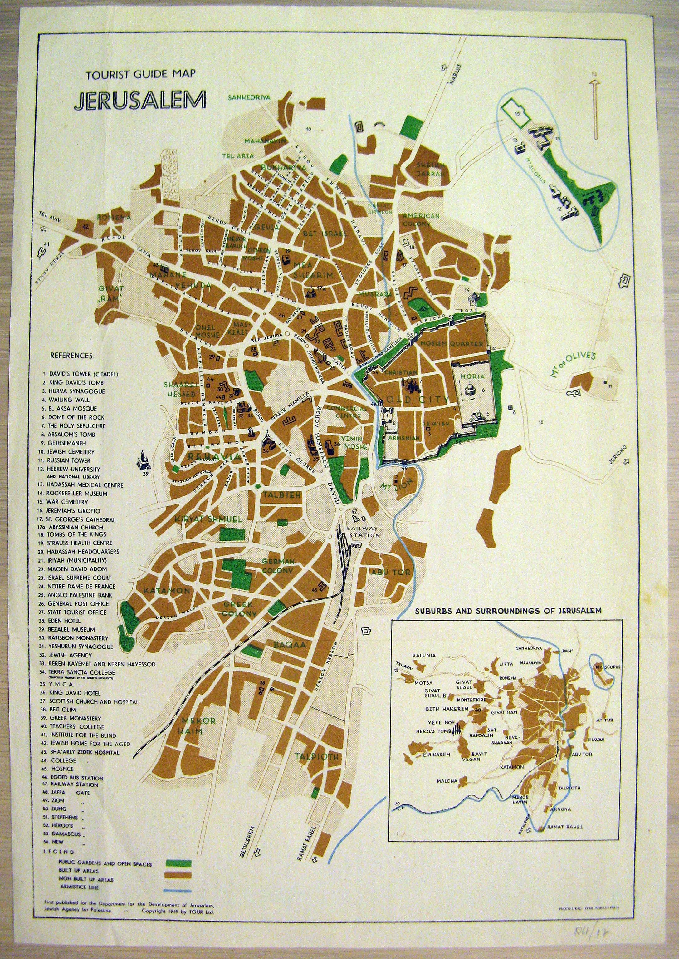
A Tourist Guide map of Jerusalem, printed several years after the establishment of the State of Israel by the Department of the Development of Jerusalem at the Jewish Agency. Prominent buildings and public parks marked by numbers and some are drawn on the map itself. The inset shows the 1949 borders, the western neighbourhoods of the city, and several outlying settlements. [VERSO:] Addresses and phone numbers of specific institutions in the city. The text outlines information about the city for visitors, including historical information and even details of cultural events. The map is in English.