Woodhead Commission Map - The C Plan of Partition  


Author --
Description
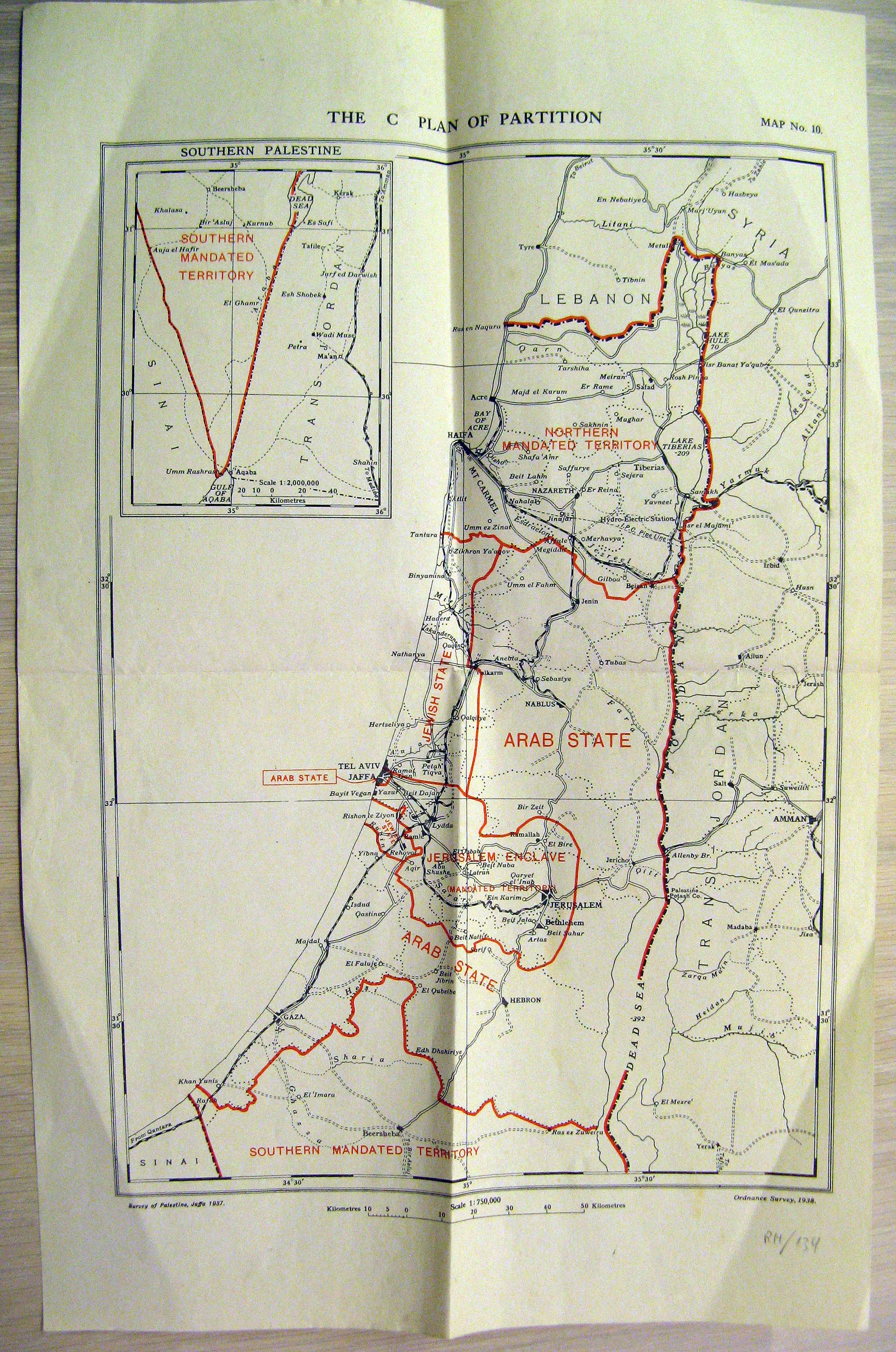
Map of "Plan C" of the proposed boundaries of the Jewish State, Arab State, and Permanent Mandates of Jerusalem and the Galilee, as proposed by the Woodhead Commission in 1938. This third plan of the commission allocated the smallest area to the Jewish State, transferring much of the area initially allocated to it by the Peel Commission to the Permanent Mandate.
Price $180.00
(Price does not include Shipping Costs!)
Catalog Index Number XT 021

Image Gallery
(Click an image to enlarge)


View more books, in related categories:
Maps & Cartography
Maps of the Holy Land

 
Homepage     About us     Advanced Search     Contact Us     Help!

6 Shatz St. (26 King George st. corner) Jerusalem
Near the Artists' House and Betzal'el Academy

E-mail: info@bookgallery.co.il

TEL: +972-2-6231087 (02-6231087)

FAX: +972-2-6255513 (02-6255513)