4 Exploration Fund Survey Maps  


Description
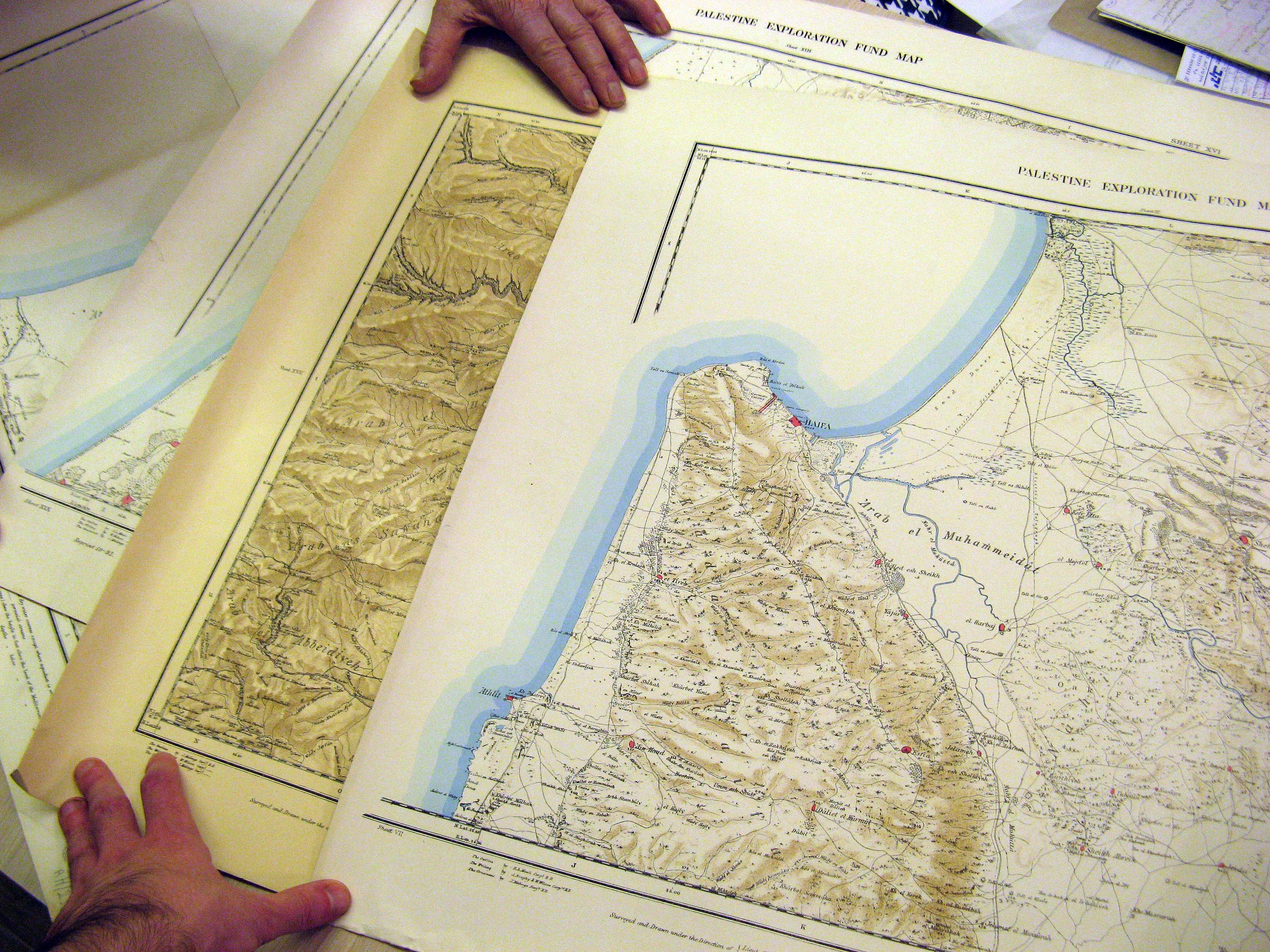
Four maps from the Palestine Exploration Fund surveys, printed in 1878-1879. These are Sheets #5, #8, #16 and #18 out of the original set of 26, and are the most highly-detailed maps of the region created in the 19th century. These sheets include the areas of Haifa/Nazareth, Jaffa, Ashdod, and the northern tip of the Dead Sea. The maps are drawn on cloth, and mounted on a paper backing.
Price $800.00
(Price does not include Shipping Costs!)
Catalog Index Number XT 027

Image Gallery
(Click an image to enlarge)


View more books, in related categories:
Maps & Cartography
Maps of the Holy Land

 
Homepage     About us     Advanced Search     Contact Us     Help!

6 Shatz St. (26 King George st. corner) Jerusalem
Near the Artists' House and Betzal'el Academy

E-mail: info@bookgallery.co.il

TEL: +972-2-6231087 (02-6231087)

FAX: +972-2-6255513 (02-6255513)