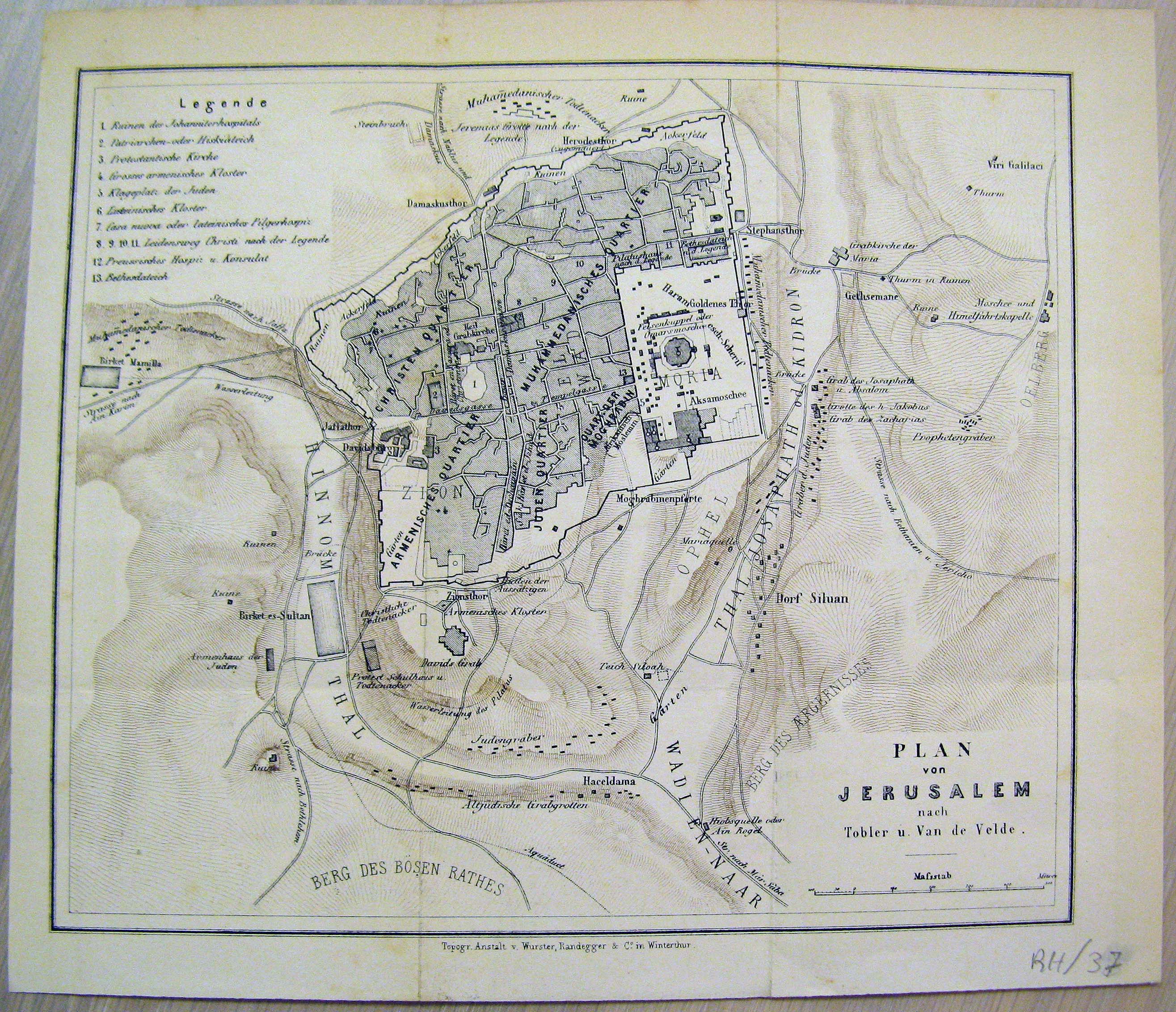
A small German-language map of Jerusalem from around the mid 19th century, made by Dr. Titus Tobler and Carl Van de Velde, probably on the basis of the English Ordnance Survey. Of note is a long house south-west of the city walls marked as "Armenhaus der Juden" ("Jewish Almshouse"), which might actually be the new neighbourhood of Mishkenot Sha`ananim, the first Jewish neighbourhood outside the walls.