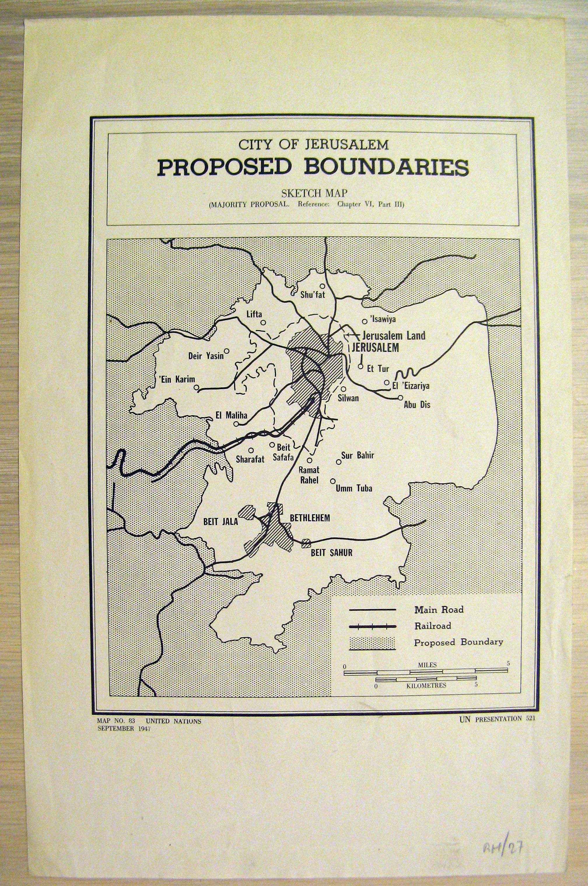
United Nations official map #83. This is a small map of the proposed boundaries of the U.N.-controlled enclave of Jerusalem. It was printed in Sep. 1947, to be presented in a U.N. session on the subject. It shows the urban and municipal areas of Jerusalem and Bethlehem, major Arab villages in the vicinity, the Jewish Kibbutz at Ramat Rahel, and the road and rail network running through the area.