טוען נתונים, אנא המתן ...
|
שם המחבר
|
--
|
|
תיאור הפריט
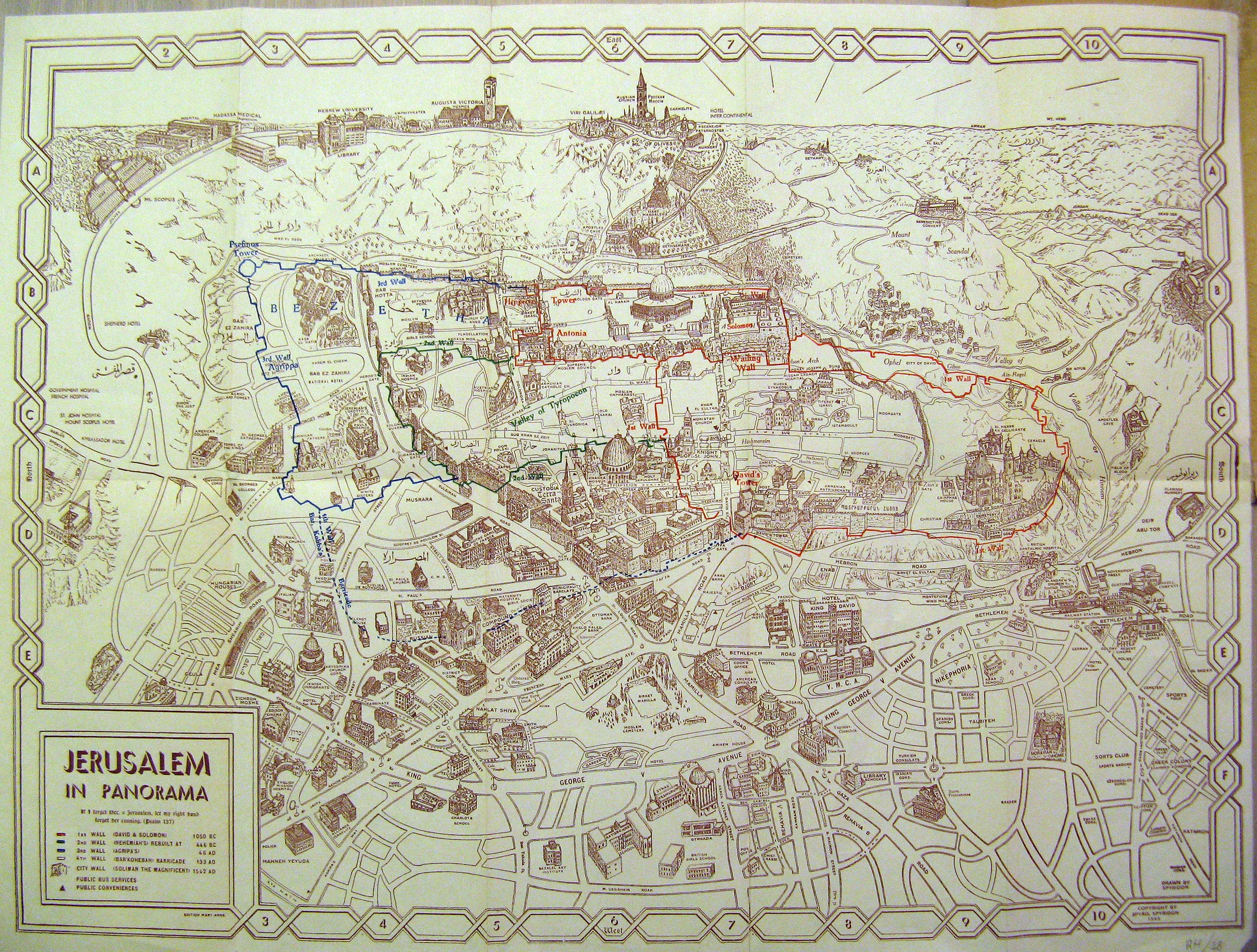
A hybrid panoramic/schematic map of Jerusalem as seen from the west. Printed in 1945. The map extends right (south) to the German Colony, down (west) to the Ratisbonne School, up (east) to the Mt. of Olives, and left (north) to Mt. Scopus. The colored lines were drawn by hand (as part of the original map) to delineate the location of the four different historical wall sections of the Old City of Jerusalem. Most place-names are in English, with a few additional labels in Hebrew and Arabic.
|
|
מחיר
|
₪645.00
+ משלוח
|
|
מספר קטלוגי
|
XT 017
|
|
גלריית תמונות
(להגדלת תמונה, הקלק עליה)
|
|
|
ספרים נוספים בנושא:
מפות וקרטוגרפיה
מפות ארץ ישראל
|