טוען נתונים, אנא המתן ...

|
|

|
|
|
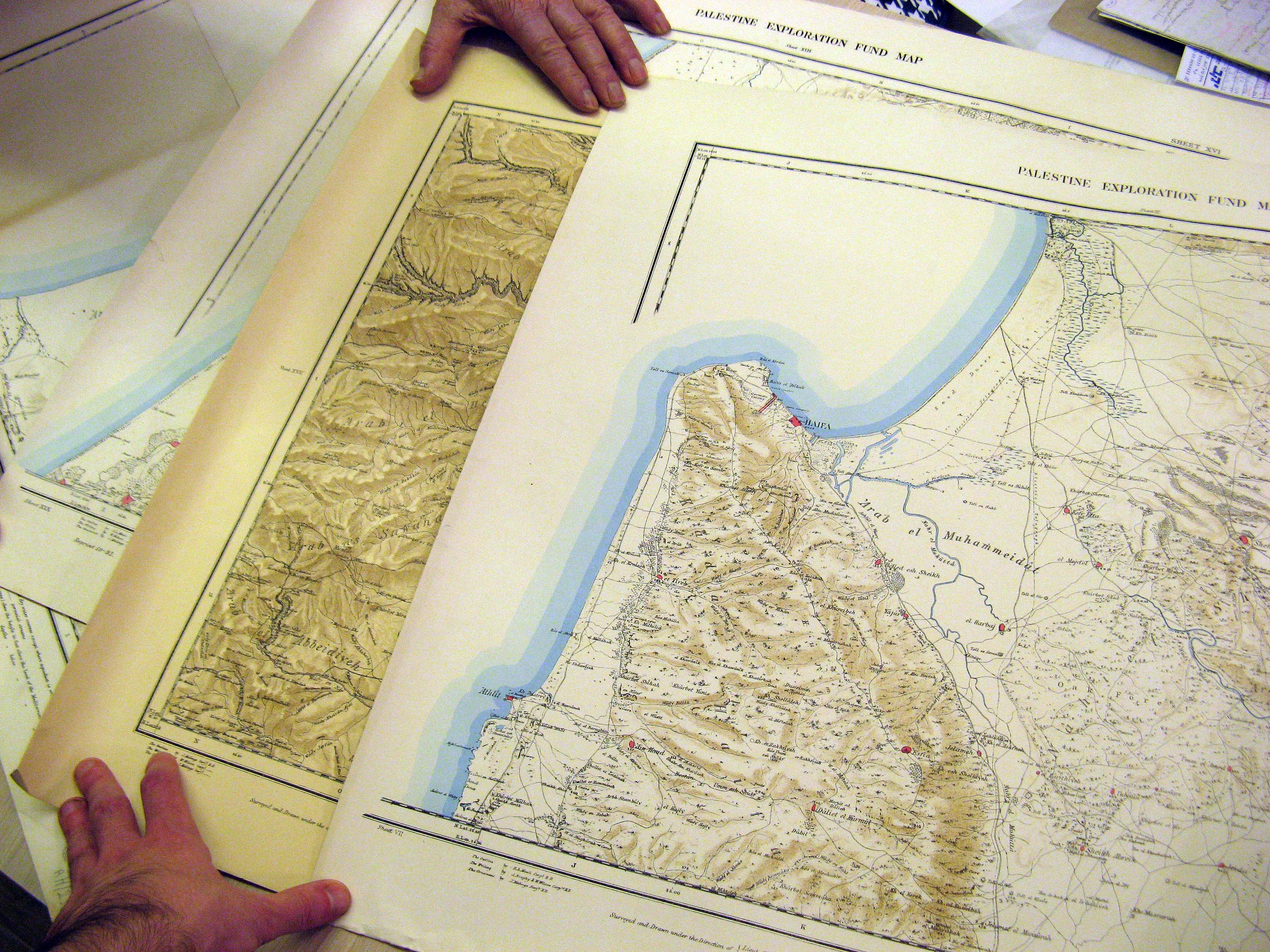
4 Exploration Fund Survey Maps
|
|
|
|
|
|

|
|

|
|
תיאור הפריט
Four maps from the Palestine Exploration Fund surveys, printed in 1878-1879. These are Sheets #5, #8, #16 and #18 out of the original set of 26, and are the most highly-detailed maps of the region created in the 19th century. These sheets include the areas of Haifa/Nazareth, Jaffa, Ashdod, and the northern tip of the Dead Sea. The maps are drawn on cloth, and mounted on a paper backing.
|
|
מחיר
|
₪3,440.00
+ משלוח
|
|
מספר קטלוגי
|
XT 027
|
|
גלריית תמונות
(להגדלת תמונה, הקלק עליה)
|
|
|
ספרים נוספים בנושא:
מפות וקרטוגרפיה
מפות ארץ ישראל
|