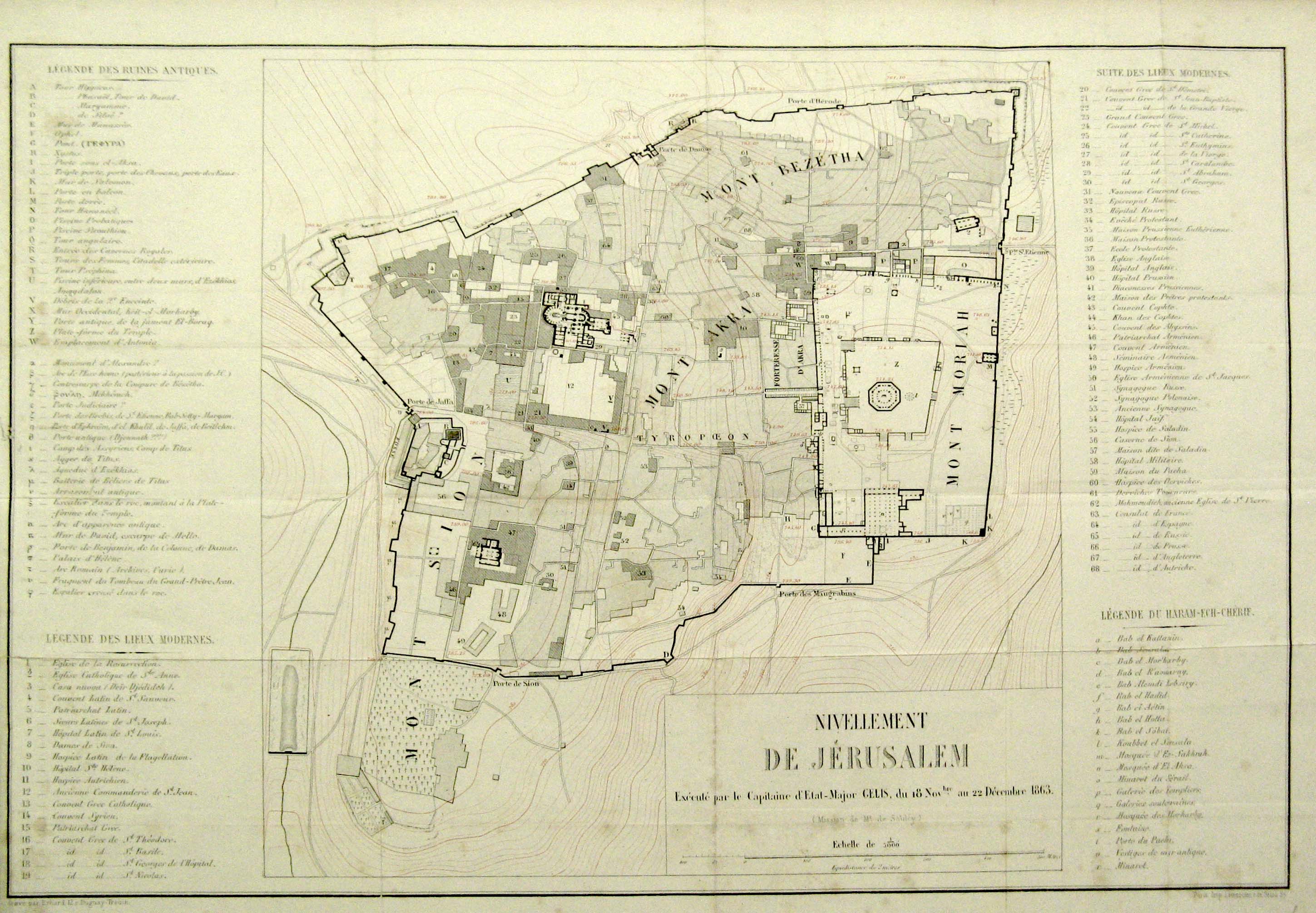
Nivellement de Jérusalem [Jerusalem Heightmap], 1863
שם המחבר
M. Gelis
תיאור הפריט
A topographical/schematic map of Jerusalem surveyed by M. Gelis as part of Louis de Saulcy`s second expedition to the Holy Land in 1863. The topographical aspect of the map includes accurate height measurements at many different points around the city. Marked on the map are 47 ruins and antique structures, 68 prominent buildings in Jerusalem at the time, and 20 important features of the Temple Mount compound. The map is flanked on both sides by a full index of these markers alongside the names of the associated buildings/features. Both the map and index are in French.