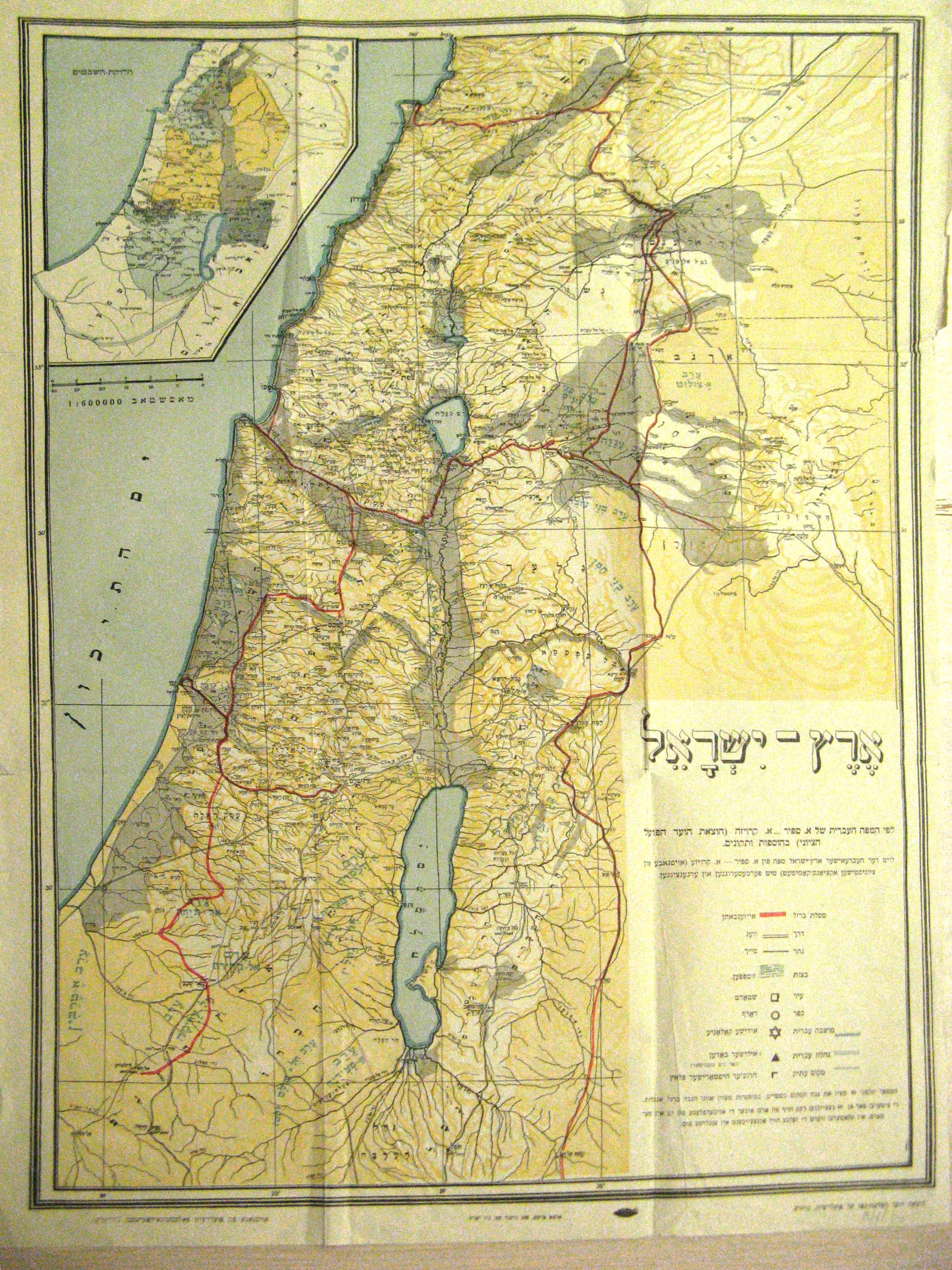
An early 20th century topographical map of Palestine and the East Bank (western Jordan), by cartographers Sapir and Kreuze. This map includes markings of the Hebrew and Arabic names of various regions in the area. Railways and important features are also marked. An inset shows a map of the distribution of the 12 Tribes of Israel in Biblical times. Published by the Eretz Israel Committee of the Laborers of Zion [Po`ale Zion] and printed in New York. The map is in Hebrew, Yiddish, and Arabic-to-Hebrew transcript.